Learn how you can safely use drones & mapping software to create high-quality data while saving time and money!

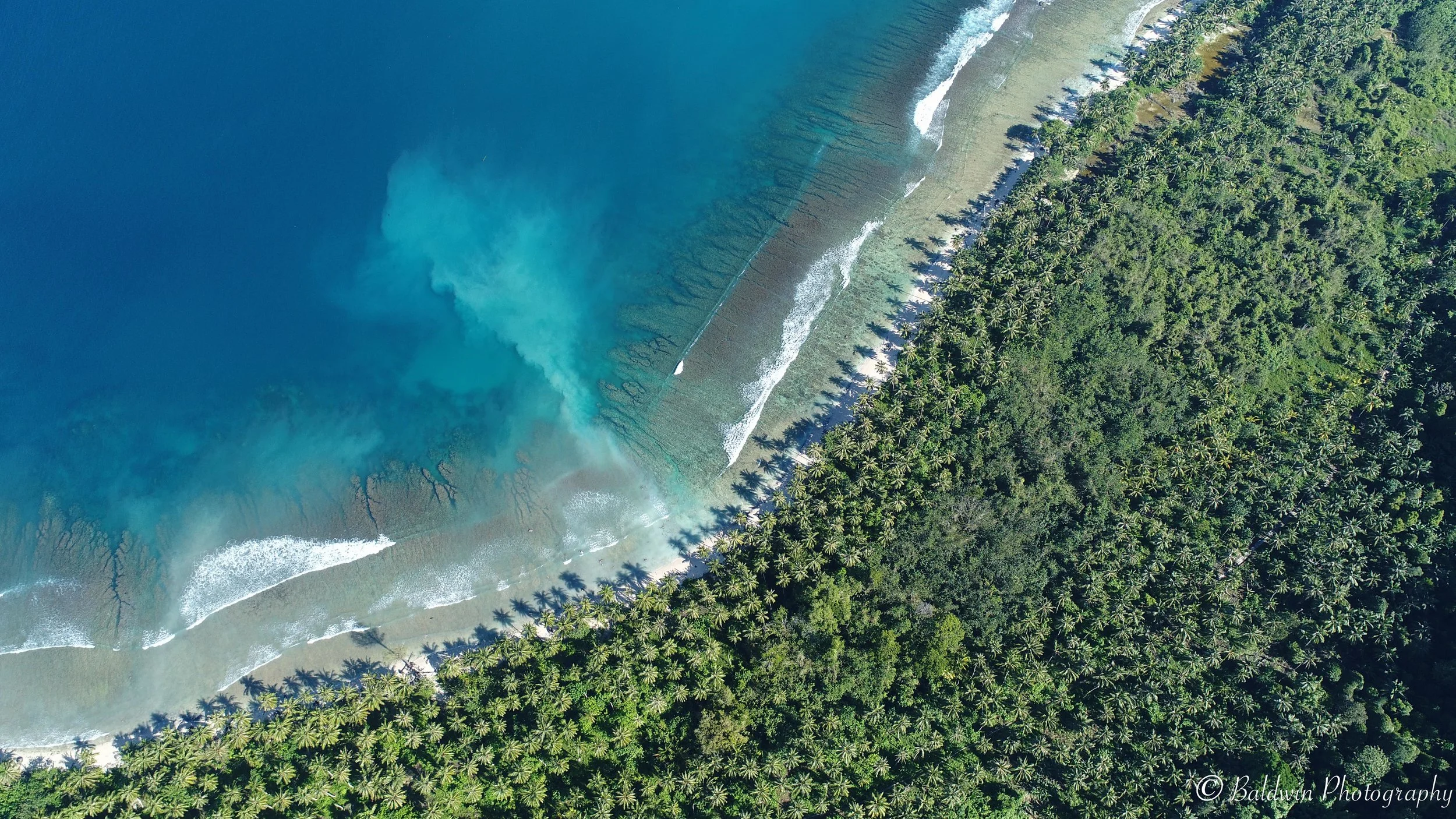
Drones can collect more precise & higher resolution imagery than satellites
DRONES ARE REVOLUTIONIZING ENVIRONMENTAL MANAGEMENT
As technology continues to evolve, drones – also known as unmanned aircraft systems (UAS) - have become an invaluable tool for mapping the environment.
Drones now allow us to easily reach and map areas that were previously inaccessible. When used correctly they are safe, minimally invasive, and cost significantly less than traditional aerial surveys. Add the right drone software and analysis tools, and 3D measurements can be conducted with ease!
Drones can improve your environmental monitoring needs, whether that involves assessing resources, determining impacts or planning management efforts. Drone technology today allows you to easily collect aerial images and quickly generate high-resolution, true-to-scale maps and 3D models, so you can produce high-accuracy data and information.
Learn how to use off-the-shelf drone technology so that you can easily plan, conduct surveys and obtain your own aerial data to create an accurate and comprehensive environmental information to improve your decisions!

Plant Health Assessment Permaculture Farm, Quail Springs, California.
Develop the Skills You Need to Effectively Gather, Analyze & Share Your Drone Mapping Data!
I offer various (in-person and virtual) training courses that will teach you the relevance of how drone technology can be applied within your industry and data needs. You will not only be taught how to fly safely but will also gain understanding of the different types of drones, payload sensors and equipment you’ll need. I will teach you how to use the most popular flight planning, mapping, modeling and analysis software packages. Ultimately, you will be able to determine the most appropriate and cost-effective solutions to meet your needs, so you can collect aerial data and create highly accurate maps. You will also learn how to conduct 3D spatial analyses, produce informational reports and widely-share all of your results with your audience.
LEARN HOW TO YOU CAN CREATE

OrthomosaicS
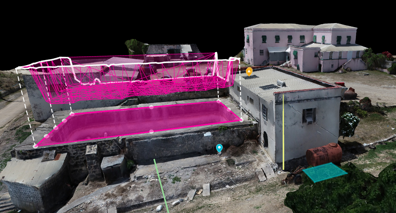
Generate 2D Maps, 3D Models & Point Clouds

Elevation surfaces
Analyze Slope, Produce Contours & Model Flooding in 3D
measurements & spatial analysis
Determine Locations, Distance, Areas, Volume, Slope, Elevation Profiles

plant health
Count Plants, Crop Productivity Tools & Field Management Techniques
3D Models
Easily Conduct ‘True to Scale’ High Accuracy Measurements & Flag Issues
“Dr. Baldwin is extremely knowledgeable and helpful. Her teaching approach was methodical, covering the background information on UAVs, their usefulness in research and the reasons for flight regulations. She was patient as we learned the basics of pre-flight preparations and flight with UAVs and was very effective at teaching our team the differences between and benefits of the available software. I would recommend training with her to anyone interested in using drones for research”
