
Allows us to integrate diverse information across various scales and disciplines providing an effective data management framework
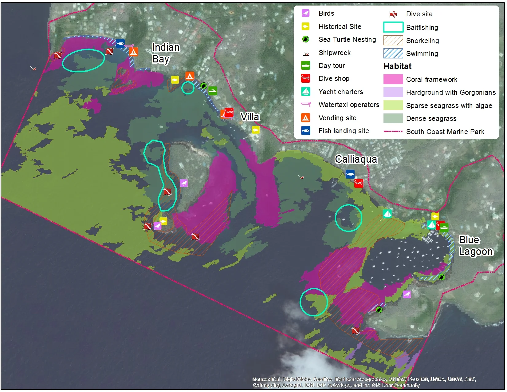
Map of marine habitat and space-use ocurring in the SCMMA, St. Vincent.
Our need to integrate, analyze & understand Our environment & its’ uses has increased reliance on Geographic Information Systems (GIS)
GIS is a tool that can allows us to model the environment and conduct spatial analysis by querying, summarizing information on our resources and corresponding human activities. This not only enables us to clearly visualize our world but can serve to improve a shared understanding of our ecosystem & challenges.

Marine habitats of the South West Watershed Demonstration Area, Antigua.
I offer GIS courses ranging from introductory to advanced spatial analysis tailored to your skills

GIS for environmental management

Sargassum mapping in Barbados.
Geoinformatics for Environmental Management
This course introduces Geoinformatics - and how working with spatially-referenced data can provide a better understanding and interpretation of interactions occurring within the environment. You will learn the five key elements of GIS and how they should be applied to support an ecosystem-based management approach. Both theoretical lectures and practical activities (using either ArcGIS and/or Google Earth) will provide you with a solid understanding of how to apply geoinformatics to support your environmental applications.
DATA CONVERSION, CREATION AND GEODATABASE CONSTRUCTION
Learn how to design for the collection, conversion & creation of spatial data!
Guidance is provided each step of the way - from conducting a preliminary needs assessment, followed by planning for data collection, mapping methods and data conversion techniques. It doesn’t end there - the importance of managing your data appropriately is an essential, yet often forgotten element, to ensure high quality information so how to efficiently manage your data and effectively implement QA/QC procedures will also be covered.
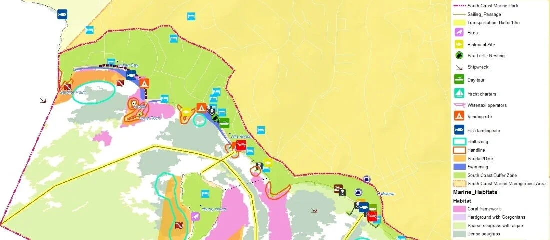
South Coast Marine Park, St. Vincent


Public Sector Smart Energy Programme, Ocean Energy Project, Division of Energy Barbados, 2018.
introduction to Spatial Analysis
Learn approaches to problem-solving by exploring spatial patterns, trends and relationships within your GIS data! You will be introduced to the most commonly used geospatial analysis and will gain experience performing analysis using web-based mapping and analytic tools. If your organization has specific learning needs in this area, ask me about custom-designed courses tailored to meet your needs & goals!